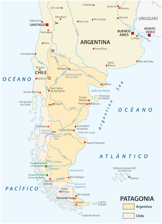
We leave SFO mid-day on February 2, Ground Hog Day, and fly to Houston for a 3.5 hour layover. After leaving Houston we fly 9.5 hours to Santiago, Chili for an overnight. Then on to Puerto Montt and Puerto Natales in Southern Chili. This will be our most southerly point. This map is a nice image of what we fly over. The second map is more clear as to our destinations.

From Puerto Natales (the red dot near the southern end of Chile) we drive to Torres del Paine, a National Park in Chili (the lower green star). Our accommodations are at a place called Explora Patagonia, somewhere in the park. From the airport we will be driven 112 miles to our hotel. We will stay at Explora four nights and do our activities from there. Then we will be driven to Glaciers national Park, a 9.5 hour ride, to another hotel for a few more days. More on all that later. We do end up in Uruguay for several days before coming home from Monte Video.
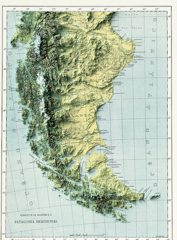
The third image is a dense topographical map of Patagonia. It demonstrates the attraction to the area for people wanting to hike, take awesome photos and get away from crowds. I have read that we will not be hiking above 3800 feet in elevation even though there are several tall peaks and many hikes of multiple lengths. Hopefully my knee will be able to hike all we want.
This map makes the land look daunting. I believe we will be near 54 degrees latitude and in the middle of the mountains. I will be more definitive when I know more.
THE TIP OF TIERRA DEL FUEGO IS THE MOST SOUTHERLY POINT ON EARTH TO WHICH MAN HAS WALKED. HE ARRIVED THERE SOME 10,000 YEARS AGO, BASED ON ARTIFACTS FOUND IN THE AREA.